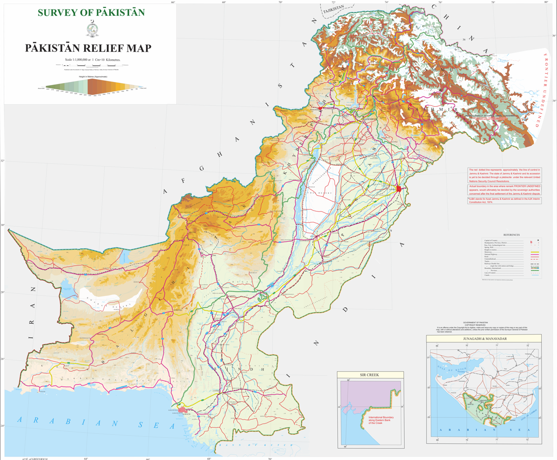
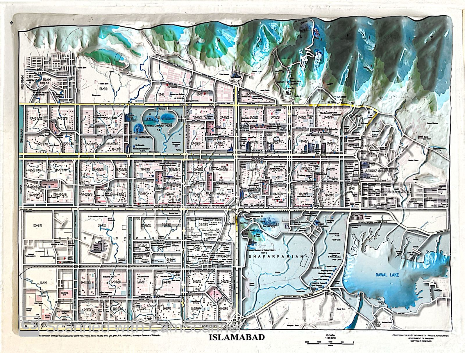
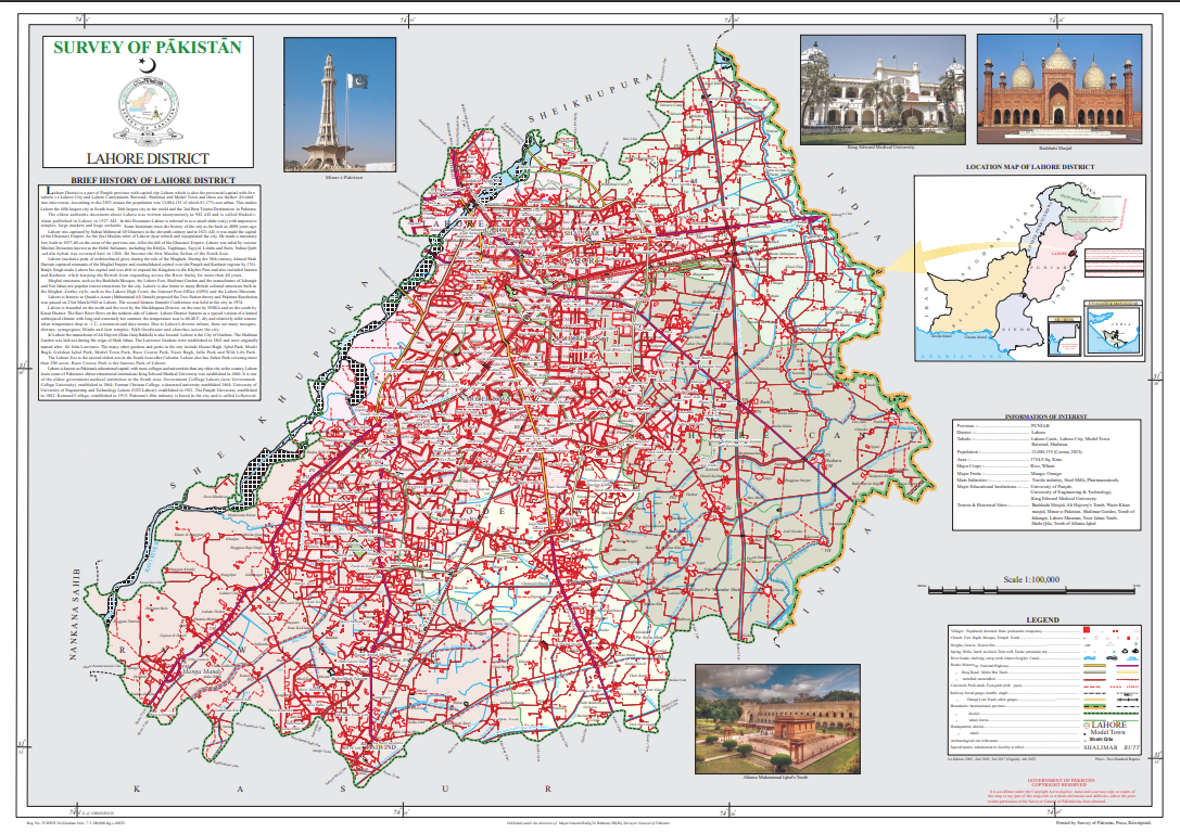
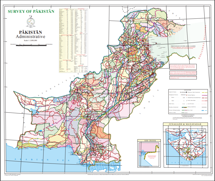
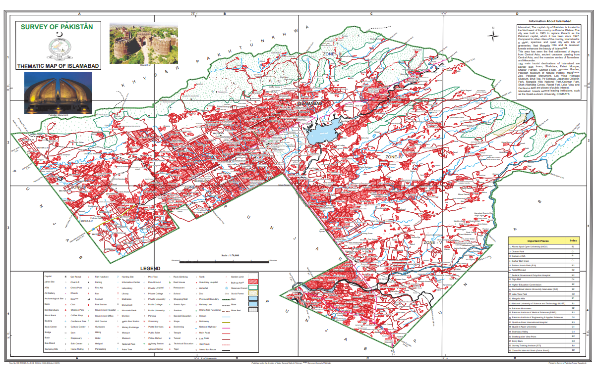
Who uses our maps?
Our maps are widely used for national security and border management, preparation of classified maps for the Armed Forces, construction of airports, dams, canals and highways, urban and rural planning, disaster management and environmental studies as well as education and research