Data products
Products
Go to
Our Data hub
Search for product
License Requirements
Services
Our Services
Customers
Customers
About
News & Briefs
News & Events
hello world!
Search
Menu
Close
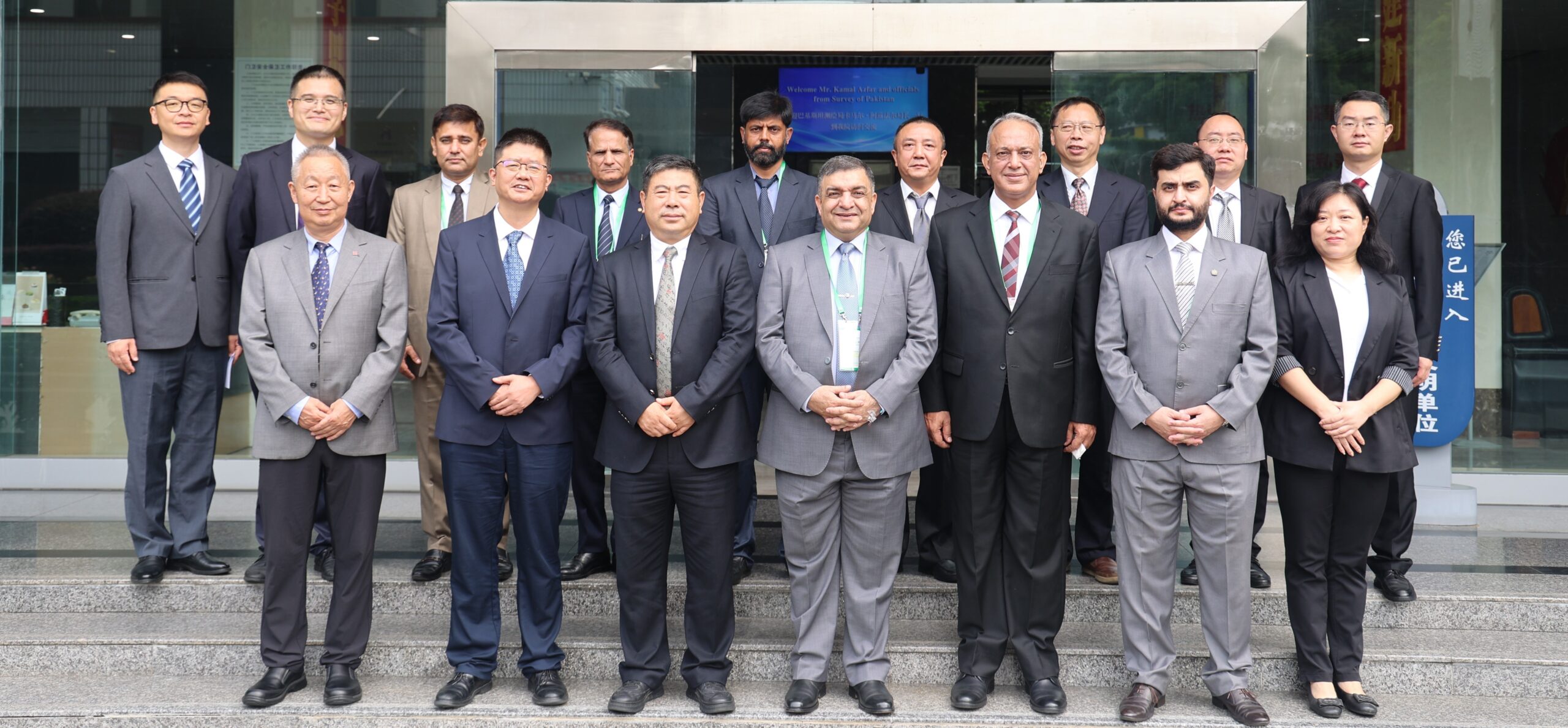
The 4th Technical Training Program for 19 Survey of Pakistan personnel, organized by the Sichuan Bureau of Surveying and Mapping, is currently being held in Chengdu, China. A Pakistani delegation, led by Surveyor General of Pakistan, visited China from 3 to 9 September 2025 on the eve of inauguration of the training program. During the visit, follow-up coordination meeting on Next-gen Geodetic Datum Project was also held to ensure its effective execution. This project will lay the groundwork for Pakistan to implement real-time navigation and positioning services and establish tidal gauges critical for coastal and marine mapping.
The delegation visited the 3rd Photogrammetry and Remote Sensing Institute in Chengdu and 3rd Geoinformation and Mapping Institute in Chongqing. During technical discussions, the Chinese team reaffirmed its commitment to strengthening bilateral cooperation in the fields of surveying, mapping and geospatial sciences. They also expressed willingness to collaborate on a future project focused on developing a comprehensive GIS platform for Pakistan which will contribute to establishing a well-defined National Spatial Data Infrastructure (NSDI).
The initiative traces back to 2011 when Government of Pakistan formally requested technical assistance from Government of China to help develop modern geodetic infrastructure for Pakistan. The project was officially inaugurated in May 2023 and aims to develop a robust and precise spatial reference framework that supports mapping activities along the China-Pakistan Economic Corridor (CPEC). This partnership continues to be a cornerstone of China-Pakistan scientific collaboration and paves the way for future innovation, technical advancement and long-term development in geospatial sciences in Pakistan.